


Garmin eTrex Touch Handheld GPS | Touchscreen with TopoActive Maps

Garmin eTrex Touch Handheld GPS | Touchscreen with TopoActive Maps
Description
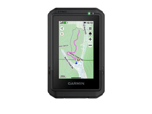
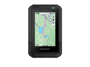
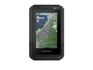
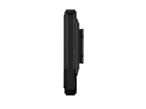
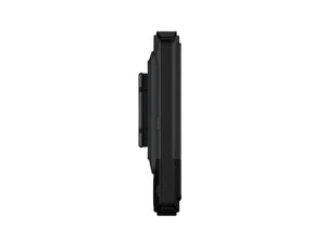
Whether you are exploring unfamiliar tracks, planning a multi-day tramp or navigating back to camp, the Garmin eTrex Touch provides dependable handheld navigation in a compact package. The responsive 3 inch touchscreen makes it easy to pan, zoom and follow your route without complicated controls.
Preloaded routable TopoActive maps help you navigate roads and trails while displaying contour lines, waterways, parks and thousands of points of interest. Multi-band GNSS support across GPS, GLONASS, Galileo, QZSS, BeiDou and IRNSS improves positioning accuracy, especially in difficult terrain where satellite reception can be challenging.
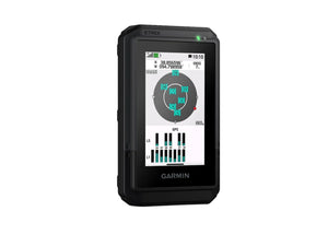
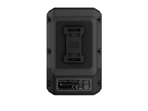
Built for outdoor use, the eTrex Touch carries an IP67 water rating and MIL-STD-810 impact-resistant construction. The integrated digital compass and barometric altimeter provide valuable navigation information even when you are stationary, while TracBack, ascent planning and round-trip routing add extra confidence on longer adventures.
Pair the unit with the Garmin Explore app to manage routes, waypoints and activities from your compatible smartphone or tablet. With up to 130 hours of battery life in standard GPS use and up to 650 hours in expedition mode, it is ready for extended trips where charging opportunities are limited. A dependable navigation companion for everything from local day walks to remote backcountry adventures.
Key Features
- 3 Inch Touchscreen: Bright colour display with swipe and zoom controls for simple navigation in the field.
- Preloaded TopoActive Maps: Includes routable maps with roads, trails, contours, waterways, parks and points of interest.
- Multi-Band GNSS Support: Uses multiple satellite systems and frequencies for improved positioning accuracy in challenging terrain.
- Rugged Construction: IP67 water resistance and MIL-STD-810 impact resistance help withstand harsh outdoor conditions.
- Long Battery Life: Delivers up to 130 hours in GPS mode and up to 650 hours in expedition mode.
- Garmin Explore Compatibility: Plan routes, manage waypoints and review trips using the Garmin Explore app.
- Built-In Navigation Tools: Includes TracBack, digital compass, barometric altimeter, ascent planning and waypoint navigation.
- Geocaching Ready: Supports Geocaching Live with cache details, logs and automatic uploads when connected.
- Outdoor Maps+ Compatible: Optional subscription unlocks premium mapping including satellite imagery and campground information.
- Wireless Connectivity: Supports smart notifications, weather forecasts, Garmin Share and Connect IQ downloads.
Specifications
Warranty
This product is covered by your rights under the New Zealand Consumer Guarantees Act.