


Garmin Montana 760i GPS Handheld Satellite Communicator | 8MP Camera

Garmin Montana 760i GPS Handheld Satellite Communicator | 8MP Camera
Description
When your adventures take you beyond mobile coverage, the Garmin Montana 760i keeps navigation, communication, and location tracking together in one rugged handheld device.
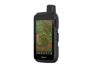
The large 5-inch touchscreen makes mapping easy to view while travelling on foot, by bike, kayak, ATV, or vehicle. Built to MIL-STD 810 standards for thermal, shock, water, and vibration resistance, it is designed to handle demanding outdoor conditions while remaining straightforward to use with gloves on.
The integrated inReach technology is one of the Montana 760i's standout features. With an active subscription, you can exchange messages, share your location, access weather forecasts, and trigger an interactive SOS through the global Iridium satellite network. When you're operating well outside normal cellular coverage, that extra layer of communication can be invaluable.
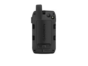
Navigation is equally capable. Multi-GNSS positioning, ABC sensors, preloaded topographic mapping, City Navigator road maps, downloadable satellite imagery, and support for additional mapping options give you flexibility across a wide range of environments. The built-in 8-megapixel autofocus camera adds another practical layer by automatically geotagging photos so important locations are easy to find again later.
A handheld GPS feels even more useful once conditions become unfamiliar and mobile reception disappears. The Montana 760i brings navigation, mapping, communication, and emergency capability together in a single device built for serious outdoor travel.
Key Features
- Global Satellite Communication: Uses the Iridium satellite network for two-way messaging, location sharing, tracking, and emergency communication beyond mobile coverage.
- Interactive SOS Alerts: Provides access to a 24/7 emergency response coordination centre when help is needed in remote areas.
- Integrated 8MP Camera: Captures geotagged photos with location coordinates attached for easy navigation back to important locations.
- Large 5-Inch Touchscreen: Glove-friendly WVGA display offers clear mapping and navigation visibility in outdoor conditions.
- Multi-GNSS Navigation: Supports GPS and Galileo satellite systems for improved positioning performance in challenging terrain.
- ABC Sensors: Includes a barometric altimeter, electronic compass, and weather monitoring capability for greater situational awareness.
- Preloaded Mapping: Comes loaded with TopoActive and City Navigator maps for New Zealand, Australia, and Africa.
- Direct Satellite Imagery Downloads: Access high-resolution aerial imagery over Wi-Fi without requiring a computer.
- Expedition Mode: Extends battery life significantly for long-duration trips away from power sources.
- Dog Tracking Compatibility: Works with compatible Garmin Astro and Alpha handheld systems for outdoor dog tracking applications.
- Vehicle Mount Compatibility: Adapts to a range of mounting solutions for use on vehicles, boats, motorcycles, and ATVs.
- LED Flashlight Beacon: Adds practical visibility and emergency lighting capability when conditions change.
Specifications
Warranty
This product is covered by your rights under the New Zealand Consumer Guarantees Act.